A major component of transportation planning is the ability to analyze system conditions, performance, and test various improvement alternatives using predictive modeling application. Transportation modeling uses state-of-the-art analysis tools to support critical transportation planning and major capital investments decision making.
Transportation models, to the most extent possible, are used to replicate the “real world” in terms of environmental impacts; system performance; and agency operation impacts. Transportation mod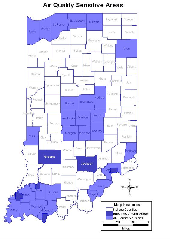 els are also used to predict changes in travel patterns and the utilization of the transportation system in response to changes in regional development, demographics, and transportation supply. Transportation modeling is a challenging task, but one that is required for rational planning and evaluation of transportation systems.
The Modeling Team utilizes various planning analysis tools that support various capital management programs, asset management and investment decisions. The Technical Modeling Team consists of a multi-disciplinary team of engineers, planners, computer programmers, and transportation professionals. The Modeling Section provides technical modeling needs analysis and support to our various customers:
- Asset Managers
- Transportation Planning Staff
- Production & Project Managers
- Feasibility & Design Engineers
- Contract Consultants
- Metropolitan Planning Organizations
- Regional Planning Organizations
- Federal Agencies
- Neighboring State DOTs
Services Information
Emissions Modeling – The Technical Modeling Team is responsible for conducting emissions analysis as part of federally mandated air quality conformity regulations. Our office is responsible for rural areas designated as non-attainment areas by the U.S. Environmental Protection Agency. As part of the process, INDOT staff work closely with the Indiana Department of Environmental Management, U.S. Environmental Protection Agency, INDOT District Offices, Metropolitan Planning Organizations, Regional Planning Organizations, the U.S. Army Corp of Engineers, county officials, and others partners to determine:
- State Implementation Plans – Air quality conformity budgets
- Evaluate proposed INDOT improvements relative to air quality conformity
- Determine transportation generated pollutant levels: ozone, Carbon Dioxide and Particulate Matters (PM 2.5)
Travel Demand Modeling – The Technical Modeling Team is responsible for the development and maintenance of the department’s Statewide Travel Demand Model (ISTDM). The model is used to predict changes in travel patterns, freight redistribution and the utilization of the transportation system in response to changes in regional developments (new/wider roads, new buildings, shopping malls, large industries); changes in the land use (such as more residential developments or new industrial sites); changing demographics (more or less people in a specific area or more residents driving) and transportation supply.
TransCAD has been chosen as INDOT’s modeling software package. The software transportation package integrates the modeling algorithm with a Geographical Information System which offers a number of productivity and accuracy benefits. The ISTDM is used for: systems-level performance analysis; new corridor alternative analysis; input into other planning/modeling tools; long range planning analysis; initial origin-destination project studies; and project scoring and evaluation exercises.
Economic Modeling – INDOT is recognized as a leader in the use of select modeling applications for evaluating the economic impact of major capacity and preservation roadway improvement investments. The INDOT Modeling Team utilizes several economic modeling tools and packages: Regional Economic Modeling, Inc. (REMI) and Transportation Economic Development Impact System (TREDIS), EconWorks sketch planning tools, and several tools developed by Purdue University. These applications and tools monetize benefits such as: reduced travel times, accident reduction, vehicle operation cost reduction, and improved vehicle emissions. These application are also used to evaluate proposed improvements, recommend new improvements, tradeoff analysis, optimized decision-making and fiscal constraint analysis.
Simulation Modeling – The Technical Modeling Team provides real-time (planning level) traffic simulations in 2-D and 3-D formats. Simulation models allow the testing of various improvement strategies such as: interchange modification, ramp metering, HOT lanes, intersection improvements, roundabouts, and can simulate emergency road/lane closures. INDOT has chosen TransModeler as its simulation package which integrates with our TransCAD statewide travel demand. The modeling package is also unique in that it performs dynamic traffic assignment. This allows for more realistic traffic assignment which allows vehicles to divert to other routes during extreme congestion, road, and lane.
Contact Information
Korey Chu
Modeling Engineer, Senior Modeler
kchu@indot.in.gov
Frank Baukert
Transportation Modeler
fbaukert@indot.in.gov
Seema Alvi
Transportation Modeler
salvi@indot.in.gov