- None at this time.

The Interlake OSRA interactive map displays off-roading trails with their descriptions and difficulties, facilities, amenities, and points of interest.
Tools may be used to trace a route to determine its elevation profile and distance, filter trails by vehicle type, change the basemap, and more.
Have fun and ride safely.
Note: Trail ratings serve as a general indicator of difficulty and are subject to change after inclement weather, seasons, and continued use.

200 E. State Road 68
Lynnville, IN
Interlake Off-Road State Recreation Area (OSRA), a former coal mine land straddling Pike and Warrick counties, is a multi-use recreational facility focusing on off-road vehicle (ORV) recreation. Interlake is approximately 3,550 acres with nearly 100 miles of trails and 17 lakes (many of which can be accessed for fishing). The three areas of mining and reclamation create a variety of trail experiences for ORV enthusiasts, horse riders, hikers, and mountain bikers. From steep spoil banks to rolling grasslands, man-made lakes, and strip pits, Interlake offers a diverse array of topography and scenic views.
For more information about Indiana’s off-roading opportunities, visit Redbird Off-Road State Recreation Area (OSRA)
- Off-road vehicle recreation – All vehicle types welcome.
- Full-size vehicles (Jeeps, trucks, etc.)
- Dirt bike
- ATV (four wheeler, quad)
- UTV (side by side)
- Home built
- Mushroom hunting
- Hunting
- Fishing
- Trapping (permit required)
- Dog training
- Horseback riding
- Hiking
- Non-motorized or electric boating
- Mountain biking
Trails are open sunrise to sunset, seven days a week. Trails may be closed due to hazardous conditions. Please call 812-922-0002 for current trail information.
The Annual Entrance Pass admits the driver and passengers to Interlake OSRA and Redbird OSRA but does not provide access for motorized trail use. An Annual Off-Road Vehicle Trail-Use Permit or a Daily Trail Pass is required to access off-road trails with a motorized vehicle.
Entrance fees
| Entrance Type | Fee | Comment |
|---|---|---|
| Motorized (Off-Road) Trail Use | ||
| Daily ORV Trail Use | $15 | Per ORV; includes entrance to property |
| Annual ORV Trail Use Permit | $95 | Per ORV; unlimited trail use |
| Out-of-State ORV Trail Use Permit | $20 | Per ORV; for non-registered out-of-state ORVs only |
| Non-Motorized | ||
| In-State Daily | $7 | Per vehicle |
| Out-of-State Daily | $9 | Per vehicle |
| Entering as pedestrian, bicycle or horseback | $2 | Per person |
| Daily Horse Permit | $5 | Per horse, required |
| Annual Horse Tag | $20 | Per horse, required |
| Annual (Park) Entrance Permit | $50 | Per vehicle; Accepted at Interlake & Redbird SRAs |
| Non-Resident Annual Permit | $70 | Per vehicle |
| Golden Hoosier Permit | $25 | Persons at least 65 years or resident eligible for Social Security disability payments under 42 U.S. C. 401 (proof of eligibility must be presented at time of purchase and disabled individual must be present in the vehicle at the time of use). Indiana residents who qualify for a DAV1 or DAV2 license plate regardless of age, and who present a completed form 32584 |
NOTE: Visitors with multiple ORVs may use a combination of an annual motorized trail use permit(s) and payment. For example, a group of four ORVs could present one annual permit and pay $45 for the remaining ORVs.Fees are subject to change.
All Indiana off-road vehicles (ORVs) must be registered or street-legal (licensed). How to register your ORV. Out-of-state ORVs may purchase an annual out-of-state trail use permit at the property gate which allows use of Interlake and Redbird trails (driving on county roads is not permitted).
- All vehicles must be registered or licensed (street legal) according to Indiana law. Please make certain you are complying with Indiana’s legal definition of ORV registration.
- Non-registered out-of-state ORVs may purchase an annual Out-of-State Trail Use permit. This allows the ORV to be used on the Interlake and Redbird trails; but, not on county roads.
- Everyone who enters the Interlake State Recreation Area must pay at gatehouse.
- No alcoholic beverages are allowed on the property. All vehicles are subject to search.
- Visitors must comply with all DNR property rules and Indiana off-road vehicle laws.
- The operator of a vehicle, SUV (Sport Utility Vehicle)*, or vehicle other than a dirt bike, all-terrain vehicle (ATV), or utility vehicle (UTV), must be at least sixteen (16) years old and possess a valid driver's license.
- The operator of a dirt bike, ATV, or UTV under the age of 16 must be directly supervised at all times by a parent or legal guardian.
- DOT-approved safety helmets are required at all times except in vehicles with fully enclosed metal cab or roll bar protection. Helmets must be worn while vehicles are in operation.
- Effective July 1, 2017. Children under 18 must now wear helmets in side-by-side ORVs and UTVs. (HEA 1200)
- Seatbelts are required to be used by all vehicle operators and occupants, except ATV and dirt bike, and overhead/roll bar protection is required for all occupants in the vehicle, SUV.*
- Passengers are not allowed on ATVs or dirt bikes, except those designed by the manufacturer for two up riding
- All off-road vehicles must have functioning spark arrestors and mufflers. No tire chains or studded tires.
- Vehicles may only be operated in designated areas and must stay on marked trails.
- Entry onto property is authorized only during posted hours of operation. The valid daily receipt must be in the vehicle operator’s possession at all times.
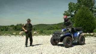
ATV Safety
Directions
Interlake Off-Road State Recreation Area Events
Loading events