- Brookville Lake Alerts (3)
- DETOUR DUE TO BRIDGE CLOSURE: Due to an INDOT project, the bridge on Dunlapsville Road over Brookville Lake (adjacent to Quakertown SRA) will be closed starting March 23 through the 2026 recreation season. There will be no through-traffic on the bridge for the duration of the closure. Visitors can follow the detour route, State Road 101 to S.R. 44 to S.R. 1 and vice versa, to access Quakertown SRA.
- BLUE-GREEN ALGAE: Found in lakes year round. Don't drink the water. Shower after you swim. More information.
- BLACK VULTURES: Birds may do damage to your vehicle. Learn how.
- Description
Mounds SRA and Quakertown SRA
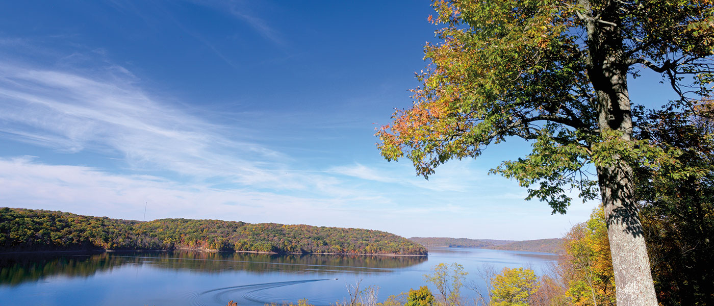
16,445 acres - 5,260-acre lakeA part of the Brookville Lake -Whitewater Memorial State Park Complex, Brookville Reservoir lies in the historic east fork of the Whitewater River Valley. Traces of prehistoric Native American mounds are still found throughout this valley. The area is known by some worldwide for its significant deposit of Ordovician fossils. These 450-million-year-old fossils, reminders of a primeval inland sea, can still be seen.
Brookville Lake is home to two State Recreation Areas: Mounds SRA (not to be confused with Mounds State Park in Anderson) and Quakertown SRA.
The lake property has more than 25 miles of hiking trails, boating opportunities, and nationally known recreational and sport fishing. Two beaches and more than 400 campsites make this an ideal family vacation spot.
Open April-August, Thursday-Sunday, 10 a.m. - 6 p.m. Quakertown State Recreation area has a 3D archery range with 23 different 3D targets, and we are in the process of acquiring more. The archery range can be found next to the camp gate at Quakertown SRA. Open to all ages. The course will be changed every week. Targets included range from small (javelina) to large (elk) and everything in between.
The area was purchased by the federal government for flood control and to provide a place for wildlife and recreation. More than 11,000 acres provide a variety of habitats for plants and wildlife. Brookville is one of the few sites in Indiana where walleye grow big enough for fisheries biologists to milk the females for eggs to supply walleye fry to many lakes in Indiana.
Brookville and Whitewater Interpretive Plan
Water safety matters! If you use one of our big reservoirs for swimming, fishing, boating, or skiing, check out Bobber the Water Dog, brought to you by the U.S. Army Corps of Engineers.
This property is a stop on the

Learn more at www.indianabirdingtrail.com. - Activities
- 3D Archery Range
- Archery
- Boating / 9 Launch Ramps
- Fishing / Ice Fishing
- Hiking Trails
- Horseshoe Pits
- Hoosier Quest Series: Explore
- Hunting
- Interpretive Naturalist Services
- Marinas (see list at bottom)
- Canoe / Kayak / Paddle Board - AVAILABLE CONCESSION OPPORTUNITY
- Picnicking / Shelterhouse
- Playground
- Shooting Range
- Swimming / Beach (Policy). Mobility mats for easy beach access are available.
- Volleyball
- Waterskiing
Camping - See campground maps under MAPS tab
- Full Hookup / 62 sites
- Electric / 388 sites
- Camp Store
- Dumping Station
INFORMATION
- Trails
DESCRIPTION OF HIKING TRAILS
Note: For trail locations, view the property map under the MAPS tab.
1. Fairfield Trail (1.5 miles) MODERATE—Extends from the southwest end of Fairfield Causeway to the Mounds Beach road traveling by the lakeshore up through an old pine plantation and crop fields.
2. Glidewell Trail MODERATE—This trail has a long and short loop that takes you past a 2,000-yearold Native American mound. The long loop is 4.5 miles and the short loop is 2 miles.
3. Templeton Creek Trail (2 miles) MODERATE—Parallels the Mounds Beach road then crosses Templeton Creek and up to the Wildlife Wander Trail.
4. Wildlife Wander Trail (.7 mile) EASY—This selfguided trail is a short loop through a mature woods. Brochures available by trail sign.
5. Garr Hill Trail (1.8 miles) MODERATE—This trail goes through crop fields and woods to the Garr Hill Boat Ramp.
6. Scenic Trail (3.25 miles) MODERATE—This paved trail is great for bicycle riding and rollerblading. Goes from Garr Hill to Scenic Vista.
7. Woodland Trail (5 miles) Moderate —A wooded alternative that runs parallel to the paved Scenic Trail.
8. Eagle Trail (2 miles) Moderate —Travel through beautiful mature woods to arrive at the Bonwell Ramp road. Simply cross the road and walk to the far corner of the parking lot to continue on Bonwell Trail.
9. Bonwell Trail (1.5 miles) MODERATE—A short connecting trail from Bonwell to the top of the dam. To continue the Adena Loop, just cross the dam to the Wolf Creek Trail.
10. Midway Trail (2.2 miles) MODERATE—Easy access to Wolf Creek Trail. Small parking lot at the end of Keeler Road gives access to trailhead.
11.Wolf Creek Trail (16.5 miles) RUGGED—Primitive hiking trail traverses the hills and ravines on the west side of Brookville Lake. It crosses no public roads or buildings. Beautiful lake views in spring and fall. Trail ends at the Fairfield Causeway. To pick up the Fairfield Trail, continue back to the east side.
PLEASE STAY ON MARKED TRAILS.
- Maps
Brookville Lake Events
Loading events

