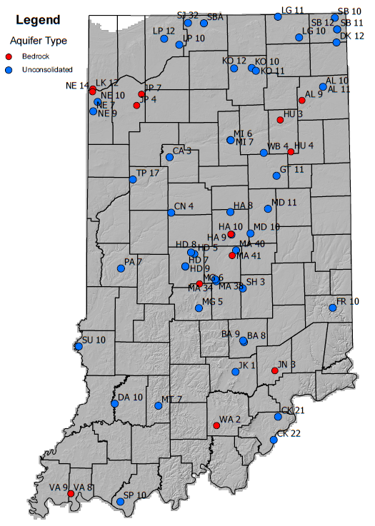
What is the Voluntary Groundwater Level Monitoring Program?
 The Voluntary Groundwater Level Monitoring Program, through tracking groundwater level trends, helps improve our understanding of the overall status and resiliency of the state’s aquifer systems. These trends include drought impacts, potential sources and sinks of water, and water availability from aquifer systems. The program incorporates privately owned wells volunteered to complement the network of existing monitoring stations to track groundwater elevations throughout Indiana. The program is a collaboration between the Division of Water's Resource Assessment section and the U.S. Geological Survey (USGS). The data is hosted here:
Benefits of Participating
Volunteers, including local utilities, homeowners, and agricultural entities, contribute by allowing the Indiana DNR to equip monitoring wells with pressure transducers to record static water levels (or depth to water surface) at certain intervals.
- Landowners can participate at no cost them.
- Participants receive access to groundwater level information for their area of interest.
- The program helps Hoosiers better understand one of our most valuable resources.
- Participants’ wells become part of a larger network of wells in Indiana and other states.
- Information gathered is used to guide use of water resources into the future, benefiting all Hoosiers
Water-use data collected by the DNR since 1985 indicates that total groundwater withdrawals for various uses such as agriculture, public supply and industry has slowly increased during the past four decades. During 2021, approximately 224 billion gallons of groundwater were reportedly withdrawn by registered significant water withdrawal facilities. Aquifer systems located throughout the state provide an important source of water for Indiana residents.
What is groundwater and why is it important to Indiana?
Groundwater is surface water that has infiltrated or “recharge” through the ground surface or along streambeds and is stored in the cracks and spaces in soil, sand, and rock. It is 90% of all available fresh water in the world.
Groundwater is contained in formations known as aquifers, which consist of materials such as sand and gravel that are permeable (i.e., have large, connected spaces between the materials that allow water to flow through). A recharge area (source) is the place where surface water enters the aquifer, and a discharge area (sink) where groundwater leaves the aquifer. Open space, agricultural areas and streams are principal recharge areas; most discharge occurs through wells and along streams.
