July 2022
Dozens of INDOT employees carefully plodded into the woods, armed with shovels, soil augers, and measuring devices in search of wetland boundaries. Their goal was to determine if the damp, wooded area was the result of recent rains or a wetland. Their training would help them find out.
Recently, INDOT Environmental Services staff from around the state gathered for four-day wetland delineation training provided by the U.S. Army Corps of Engineers (USACE), which regulates wetlands as part of its duties to protect the nation’s waters. Morning classroom training was followed by afternoon field sites at various Central Indiana locations.
INDOT is required to complete a Waters of the U.S. (WOTUS) report for all projects that may impact wetlands or waterways. This report is included with the permit application to the USACE and the Indiana Department of Environmental Management to obtain permits when a project will impact wetlands or waterways.
“Wetland delineations look at three components — soil type, hydrology, and vegetation — to determine if an area is classified as a wetland,” said INDOT Manager of Ecology and Waterway Permitting Sandy Bowman. “USACE provides INDOT with training every two years on wetland identification to include these components, so we can accurately complete required wetland delineation data sheets for the WOTUS reports to submit with permit applications.”
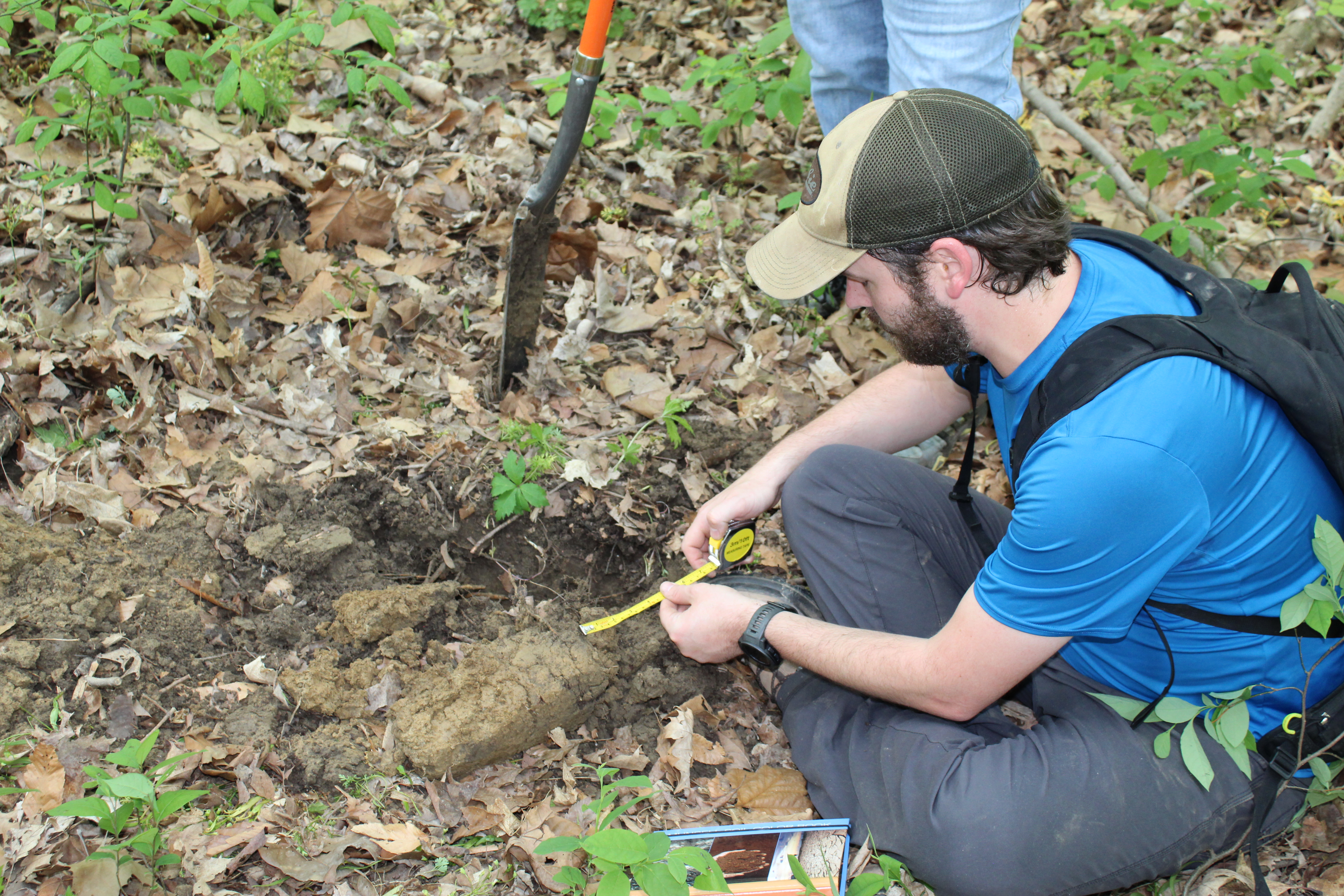
In each wetland area, participants divided into 12 groups of three. Each group followed a straight line from its spot at the edge of the woods in search of wetlands. More importantly, they tried to discern the wetland boundary of their area.
To accomplish this, they followed their classroom training. They examined various plant species for identification and changes, focused on their surroundings for hydrology indicators, and dug soil pits at various spots along their straight line.
Staffers used shovels, soil augers, and soil probes to dig soil pits up to 20 inches deep. At various depths, employees looked for hydric soil indicators, such as iron masses, loamy mucky mineral, and signs of chemical reactions caused by water. They took soil samples and matched them to soil color charts for verification. After taking inventory of all data points, INDOT workers used flagging tape to indicate the areas that they thought represented the wetland boundaries and filled out wetland delineation data sheets with their findings.
Photo Gallery: Click To Enlarge